Wednesday, October 6, 2010

A Snapshot of Autumn

...although the word on the street is we never really experienced summer. Regardless of what happened in the past few months, there is no doubt that fall has arrived. The slanted light across the prairie, clouds caught in treetops, brisk mornings, and constant desire for a cup of tea leave some (myself included) invigorated, and ready to cuddle up 'till spring. Included here are only a few of the many good moments of Fall.


It's time to enjoy a local favorite - the Hubbard Squash! Thanks to Dale Sherman and Sherman's Pioneer Farms, Hubbard Squash can be seen aplenty in the fields of Ebey's Prairie.. Simply bake these green giants open faced with butter and brown sugar for a delicious and nutritious dinner. Or get creative with pie, quick bread, stews and more! Sample Hubbard Squash prepared by Dale's wife, Liz - attend the Taste of Ebey's Workshop at the Ebey's Forever Conference November 6th.

The ferry house watches another season pass by.

Friday, September 24, 2010

The depths of Crockett Lake

Because my dad has an

adventurous, up-for-anything attitude, I took the opportunity of his recent visit as a chance to do something I've been dreaming of for awhile - kayak in Crockett Lake. This body of water, sitting consistently still yet amazingly close to the ocean had beckoned me with endless possibilities - hidden passages through the sedges, dozens of bird species, and who knows - maybe

the remains of a mammoth, buried for centuries in the mud.


Crockett Lake is situated on the western edge of the middle of Whidbey Island, separated from Puget Sound’s waters by the tenuously thin strip of land called Keystone Spit. Today Crockett Lake and Keystone Spit are home to numerous plant and wetland bird species overlooking the majestic Olympic Mountains southwest across the Admiralty Inlet, and the quiet field and forest patchwork that charmed explorers and pioneers from the mid 1700s on.

Sometimes brackish, sometimes fresh, Crockett Lake has undergone many changes since the Crockett families staked their Donation Land Claims in the 1850s. When Walter and Samuel Crockett arrived, the lake was over 500 acres. By the 1940s and 50s the lake had been drained to little more than 10 acres, making way for more farmland. Through the years, the lake levels had fluctuated depending on the status of the tidegate installed between the Lake and the Sound.

Today the lake is a shallow brackish body of water with salt and freshwater marshes and wetlands with a large rocky beach berm separating the lake from Admiralty Bay on Keystone Spit. Migratory waterfowl can land on loafing islands in the lake when the lake is low and feed on these critical feeding grounds after making their journey from the North. This special wintering and nesting area is a perfect habitat for 13 species of ducks. Nature is plentiful here with wildlife and an ecosystem that can survive the elements of a harsh windy landscape along Whidbey’s West side.

Knowing our kayaks could travel through 5 inches of water, we entered through a long, narrow channel on the Southwest side of the lake - hoping it would open up into manageable waters. Unfortunately it never did.

Instead, we had to constantly maneuver our boats to the deepest possible route, frequently digging our paddles through almost-black mud with an impossible smell. We debated turning around, but I was determined to kayak around the mysterious remains of a road, running through the center of the lake.

Progress often flirted with Crockett Lake and the Keystone Spit during the last century and a half. Anticipation of the Great Northern Railway passing through Whidbey Island on its way to Port Townsend sent speculators into a frenzy platting the towns of “Chicago” and “Brooklyn” on the Keystone Spit to take advantage of the new commerce promised by the impending railroad in the late 1880s. Within two years, it became apparent the railroad would not arrive and the newly minted town plats were abandoned. Little remains of the two towns platted for Keystone Spit, but the pilings of an old bridge crossing Crockett Lake are still visible. Around 1890, boats would arrive from Port Townsend and people would disembark carrying picnic baskets to walk across the bridge on the lake to Crockett’s Orchard for a day outing with their family. The Crockett’s allowed folks to picnic in their orchard next to the lake. The pilings are all that remain of the bridge today that once was the inspiration of big development on “the spit” that never came to be.

Although I did get stuck in the layer of thick scum that covered the water - especially around the pilings - it was pretty neat to see the multitudes of Great Blue Herons that used these upright beams as a resting place.

In the 1970s, progress again turned its eye to Crockett Lake and Keystone Spit. American affluence and recreational desires led to the next development speculation. As other coastal Whidbey Island regions developed and land prices drove higher, plans were again drawn to develop Keystone Spit, including a marina on Crockett Lake and 182 home development titled ‘Seabreeze’. The new proposals induced the local community to band together against the proposed development and fight for preservation. As the developer began constructing roads, service lines and model homes on the spit, activist group Save Whidbey Island For Tomorrow (SWIFT), the Washington Environmental Council, the Seattle Audubon Society and Dr. Cecil Riggall of Coupeville filed suit to stop the development. In time, the Army Corps of Engineers halted the proposed marina and the lawsuit against development succeeded in permanently halting the Keystone Spit development, though after roads and service lines were in place.

The push to conserve the Keystone Spit and Crockett Lake area took many turns and lots of money during the 1970s and played a large part in the creation of Ebey’s Landing National Historical Reserve in 1978. The creation of the new Reserve didn’t preclude development on Keystone Spit entirely, but updated sewage disposal restrictions made development on the spit unlikely until technology could overcome the problem in the future. Crockett Lake and Keystone Spit conservations twists and turns continued well into the 1980s before all the pieces fell into place to conserve the area as it is today.

Crockett Lake and Keystone Spit’s brushes with ‘progress’ are barely noticeable to Whidbey Island visitors today as they arrive on the Coupeville/ Port Townsend ferry to visit the local fort, or watch birds through field glasses. Visitors on the shore will notice the pickleweed in the spring, near the lake’s edge, with strings of orange dodder wrapped around its small succulent branches, and the sweet smell of the wild rose in the summer. Thanks to luck and the foresight of Central Whidbey Island residents, visitors are still able to enjoy that majestic mountain view and park-like setting so enticing to the explorers and pioneers of the past.

When our boats, covered in mud, were safely strapped to the car at the end of our trip my dad remarked, "Well, I'm glad we came. I don't need to do that again, but it was pretty cool."

Special thanks to Reserve Rangers Lauren Gansemer and Sally Straathof for their great research on Crockett Lake!


Wednesday, September 15, 2010

September 15, 2010


Ebey’s Reserve offered a glimpse of the future this morning as several guests accompanied Reserve Ranger Lauren Gansemer on a short hike from the cemetery overlook to the Jacob Ebey House. The participants heard some rarely shared back history about Isaac Ebey’s travels before settling on Whidbey Island in 1850, including his trip to California during the gold rush and his purchase of the brig ‘Orbit’ as a business venture with three other partners to head to the new Puget Sound region. They heard how Ebey was credited with naming Olympia after the Olympic Mountains he’d passed while sailing on the ‘Orbit’ and how he explored many areas of Puget Sound in his search for the perfect place to stake a claim. On October 15, 1850 Isaac Ebey claimed the prairie that now bears his name and immediately set out to persuade the rest of his family to make the journey out west. Isaac sent practical information, counseling his family and friends making the journey to transfer all their wealth into oxen and cattle, to ride horses on the trail instead of staying in the wagons, and to carry only necessary items such as food. His wife, several of her family members, and the Crockett family made the trip west in 1851. A few years later the rest of Isaac’s family followed, arriving in 1854. Isaac’s father, Jacob Ebey claimed the ridge overlooking the western side of his son’s property, naming his new land ‘Sunnyside’. Isaac and Jacob built the house that still stands overlooking the Ebey Prairie, and the destination of this morning’s hike.
Upon arrival at the Jacob Ebey house, after coffee, fruit and scones, the guests gathered at the front steps and heard Ebey’s Reserve Operations Manager Craig Holmquist give details about the restoration work done on the Jacob Ebey house over the past four years. Craig told how the original windows were restored, how a new foundation was put down is a style similar to the original foundation, and how the chimneys were lifted with the rest of the house and re-pointed by the NPS restoration crew. He pointed out the new hand split cedar shake roof and talked about the changes on the interior of the building in preparation for the Jacob Ebey House debut as the Ebey’s Landing National Historical Reserve Visitor Contact Station in spring 2011.
Reserve Manager Mark Preiss then welcomed the guests inside the house where the Long Range Interpretive Plan (LRIP) was presented. The plans are the work of many months and many people who care deeply about Ebey’s Reserve and are committed to sharing the messages central to the Reserve with visitors from around the world. With the LRIP distributed to the guests, Emi Gunn spent a bit of time reviewing the main interpretive themes, showcasing some of the Reserve’s recent achievements and talking about the next priorities on the horizon.
The Long Range Interpretive Plan, while quite a mouthful to say, is the cornerstone of all Reserve educational projects. The LRIP serves as a resource for businesses, non-profits, volunteers and other stakeholders within the Reserve to share Central Whidbey Island’s natural, cultural and historical heritage with visitors.

Wednesday, August 18, 2010

Boyer Barn project comes to a close


After four weeks hard at work on the restoration of the Boyer Barn, volunteers for the 2010 Preservation Field School will come together on Friday for a final work day and finish with a barbecue celebration of a job well done. I spoke with two members of the Coupeville Lions Club who worked on the project this year. Here is what they had to say about their experience volunteering at the Boyer Barn.

Fred Bronson shares,

"As a lions volunteer, I think it’s a great opportunity for a service org. to be involved in the preservation of the history of the area, of the island. It brings cohesiveness in the community—togetherness in the pride for what we have here.
As personal experience, I love to make things, and build things. It was new and different. There was a lot to learn. It was a great experience, and I look forward to working on any ongoing projects that will be out there. I really enjoy it just personally. Even if I wasn’t a lion, I would still do it.

It is an opportunity to see what we have today and what we do in relation to what those who originally built these structures. It just amazes me that we were able to do what they did do.

Jason [NPS preservationist and project leader] is quite good. He’s a very knowledgeable person and he works well with people. When you take a bunch of old guys who have all been bosses or in a position of direction, to handle a group of people like that is a very difficult situation. But he did excellent…the way he let people work and do what had to be done, and acceptance of ideas. I think he was an outstanding individual.

I look forward to next year’s project. it was a good crew, a good group of people. I could not describe a better experience."


And Dale Riddle adds,

"I love those kinds of projects. I like working with wood and I like the camaraderie. I like to see those little barns get preserved. We [Lions] do a lot of projects like that, building wheelchair ramps and such. It’s just something we enjoy doing. I’m retired so it’s better than sitting around getting gray."

I also had the opportunity to work a few shifts on the project. It was a lot of fun to learn what goes into the construction of a barn like that, or rather, what originally went into it 150 years ago. My favorite part was getting to work alongside the other volunteers and see the enthusiasm and dedication of everyone who came day after day to work together and make the project a success. My second-favorite part was learning to split shakes and getting to smell the sweet aroma of Western red cedar with each new shake that I peeled off the block.


Post by Sierra Young

Sunday, August 8, 2010

Clam-digging

Penn Cove offers everything from fine dining on the shore, to beautiful vistas of mountains and prairies, to protected waters for incoming vessesl, to muddy butter clam habitat. Armed with a licesnse from the Washington Department of Fish and Wildlife, a bucket, a shovel, and plenty of enthusiasm at 8 AM, Reserve rangers, Sally and Sierra, and Reserve intern, Emily, went to the head of Penn Cove to dig for clams. From our first squelching footstep in the mud to the crispy fried clam for lunch the next day, we had fun throughout the entire process.

Sally digs into the mud, knowing where to dig because she watches for where the clams squirt water as they retract their necks.
After rinsing the sand off the clams and putting them in the bucket, I count the clams to see if we are close to the catch limit of 40. These are some nice looking clams!

Filter feeders that live deep in the sand and mud, the clams were pretty dirty when we first dug them up. We certainly didn't want to eat them full of grit, so Sally had the obvious solution: "I put them in a bucket of salt water and let them spit all day."


I squealed with surprise to come back after a couple hours and find all of the clams with their necks sticking out. When I picked them up, they pulled their neck back into their shell, squirting me in the process.


Sally poses with the morning's catch.

Saturday, August 7, 2010

A Life in the Surf

Staying grounded against the constant tug of waves and changing tides is no easy task, but the bull kelp is well adapted for this kind of marine life.

Kelp resembles a plant in many ways--it performs photosynthesis and has parts that look like roots, stems and leaves--but it is in fact a member of the brown algae kingdom because it does not have distinct organs like plants. The part that looks like roots at the bottom of the stipe (stem-like structure), as in these pictures is known as a holdfast and attaches the tall kelp to the rocks. Gas bladders, known as pneumatocysts, form at the base of the blades (leaves), allowing them to float near the surface of the water. Kelp is an annual plant, meaning its life-span is about one year, but can be as long as 18 months. It reproduces by dropping spores.


(Photo by Sierra Young)

(Photo by Sierra Young)
I often look out at Admiralty Inlet from the beach at Fort Ebey and at first think I see the tops of the heads of several harbor seals, but then realize they are only moving with the water. I am actually watching bull kelp, which, while not nearly as cute as harbor seals, is nonetheless interesting and delightfully slimey to the touch.

Post by Sierra Young

Friday, August 6, 2010

Deception Pass Bridge Anniversary


Saturday, July 31, 2010
Seventy-five years ago Whidbey finally got its connection to the rest of the world! Two bridges were built connecting two counties and three islands (Fidalgo, Pass and Whidbey). It took one year to build both spans (Deception Pass and Canoe Pass), making the Whidbey connection a complete success after many years of trying.

Construction began in August of 1934, with the Civilian Conservation Corps helping to blast for the bridge approaches. Puget Construction Company out of Everett was given the contract for building both bridges. Before the bridges were built, people coming and going from the island had to rely on a "man-made" ferry service between Cornet Bay on Northern Whidbey Island and Dewey Beach on Fidalgo Island.

Deception Pass State Park had a festive celebration for the bridge's 75 years of existence, honoring the grand old structure with a ribbon-cutting ceremony and vintage pre-1935 cars crossing the bridges as was the protocol on July 31, 1935, when the bridge connection was initially dedicated.

The bridge connection has increased population on the island, built the island economy, become home to a United States Naval Base in Oak Harbor, and established Whidbey Island as a popular vacation destination. Little did anyone realize at the time of its completion that the Deception Pass Bridge would become a "must-see" tourist attraction in Washington State and the most photographed site in the Pacific Northwest.


Post by Sally Straathof, Park Ranger, Ebey's Landing National Historical Reserve

Monday, July 26, 2010

Planting in the Hedgerow

Four volunteers were hard at work with me on July 10 planting native plants, like Oregongrape and Nootka rose, in the hedgerow by the Jacob Ebey House. With the opening of the Jacob Ebey House as a visitor center, we expect more foot traffic down the farm lane, so building up the hedgerow is part of an effort to be courteous neighbors to those people living just on the other side of the fence. This was the first time planting for the three girls, yet working as a team, we were able to get 40 plants into the ground and have a lot of fun while we were at it!

Ruby holds up a Nootka rose before planting it in its new home.


Briana is working hard, but always with a smile on her face.


Madissyn digs the next hole.


After digging lots of holes in the hot sun, Nick deserves a break.


Another first for Ruby: She got to be the photographer for this one.


After the fun of planting was done, this awesome team all became Ebey's Reserve Junior Rangers.

From everyone at the Reserve, thank you to the volunteer crew!

Post and photos by Sierra Young

Jacob Ebey House


The National Park Service crew has been hard at work restoring and renovating the Jacob Ebey House. On the way to Perego's Bluff from the Sunnyside Cemetery, the Jacob Ebey House overlooks Ebey's Prairie and is the future home of a visitor contact Station for Ebey Landing National Historical Reserve.

The house was built in 1855 by Jacob Ebey, father of Isaac Ebey. Isaac staked his donation land claim on Ebey's Prairie in 1850, and that swath of land from Ebey's Landing back to Cook Road still looks much like it did 160 years ago.

The house has also changed very little from the outside, except for the ramp, which was added to make the house accessible. Go for a walk on the Bluff Trail and be sure to pass by the Jacob Ebey House to check out the progress over the next several months. We hope it will be open to the public with our first exhibits by next summer.


Post and photos by Sierra Young

Thursday, July 15, 2010

Boyer Barn


To learn little bit more about the history of the Boyer Barn and the farmland there, I spoke with Freeman Boyer. This year's Preservation Field School Project is to install new cedar shake shingles, using historic construction techniques, to the roof of his barn. The structure has been in continuous use since the 1860's, and hopefully with this community restoration work, it will stand for another 150 years or more.


Here is what Freeman had to share.

Hugh Crockett came here in 1862 and staked out a claim of 160 acres under the Oregon Land Act. He married Rachel Bond. Hugh Crockett was the first sheriff of Island County. He then sold his claim to Captain B. F. Loveland. Loveland sold it to the Kaehler family. They sold the land to James Huston after many years, in 1942. James Huston, however, was not much of a farmer and did not have aspirations to devote his life to working this piece of Crockett Prairie. In fact, as Freeman tells it, Huston only bought the land as a way to avoid being drafted for WWII. Thus, he sold it only two years later to Freeman Boyer Sr. in 1944. Freeman Boyer started working on the farm as a young boy and took it over and farmed with his father until he took over the operation.

When I asked Freeman what they farmed, he said matter-of-factly, "We farmed just about anything we could make a nickel on." This meant they grew barley, wheat, and various vegetables. They also raised sheep and would rotate both crop fields and sheep pastures. While the sheep were on a particular field, they would eat the grass, but they would also fertilize the soil for the next round of crops that would be planted there once the manure was tilled into the topsoil.

Going into the barn, Freeman pointed out that the barn was constructed entirely without nails. Instead, the hand-hewn beams were fitted together using a tongue-and-groove technique.


The barn used to have a second-floor loft for storing loose hay before they used bales. Now the barn is open from the wooden floor all the way to the roof, but the beams that supported the second floor are still intact. Bales could be stacked much higher and did not need the same air flow that piles of loose hay did, so the loft was no longer necessary. However, the original hay hook still hangs in its track on the ceiling of the barn.


The other piece of machinery that sits in the barn, no longer in use, is the floor saw. It is the predecessor to the modern chain saw and has a seven-foot blade and a one-cylinder motor for cutting logs. Two people could move the heavy saw.


Post and photos by Sierra Young

A Modern Take on Historic Barn Raising!

Volunteers needed for 3rd annual Ebey's Reserve Community Barn Raising Project at the Boyer Barn

The Trust Board's 2010 Preservation Field School will focus on completing the protection of one of the Reserve's oldest barns--the Boyer Barn on Crockett Prairie, circa 1860. The Trust Board, National Park Service, Coupeville Lions and volunteer crew members will complete the restoration of the barn's cedar shake roof using historic techniques, which began in 2009. The Preservation Field School is scheduled to run four weeks, July 19-August 12th.

Field School participants will experience, first hand, what it was like for pioneers to build barns--before electricity, heavy machinery, or modern convenience. This is an opportunity to split cedar shakes with mallets, pound nails, work aside friends, and experience the satisfaction of helping retain an invaluable historic resource for another 150 years.

"The preservation field school introduces a new kind of community barn raising," said Mark Preiss, Reserve Manager, "instead of community coming together to build a new barn, the community is coming together to restore one of its heritage buildings--as well as learning and applying the preservation trade."

"Restoring old buildings is a real pleasure," adds Ron Boyer, Coupeville Lions member. "We learn techniques and methods on how to preserve old buildings, actually restore a valuable barn, enjoy the company of other volunteers and appreciate the work that is accomplished."

The Trust Board seeks volunteers to complete the project. Volunteers with any range of experience are welcome, especially individuals with a background in carpentry and construction. The four-week Field School will run Monday through Thursday from July 19 to August 12, 8 AM to 5 PM.

Sign up to participate as a member of the crew today! Volunteers are welcome for one day, or for all. Shifts are 8am-Noon and 1-5pm. Pre-registration is required; sign up at 360-678-6084, emi_gunn@partner.nps.gov.

Program Background

The Reserve's field school was established in 2008 to provide technical support to the owners of the Reserve's historic buildings, and to gove community members a hand-on opportunity to help preserve nationally significant buildings for future generations.

National Park Service Preservationist, Jason Benson will manage the project and oversee the crew of volunteers. All work will be consistent with the Secretary of the Interior's Standards for the Treatment of Historic Properties.

Benson attributes previous restoration project success to volunteer engagement. "The sheer enthusiasm and energy the volunteers bring makes the job easy," Benson said, "It is inspriing to witness people obtaining a new set of skills at all ages and finding meaningful ways to give back to their community."

In 2009, the field school completed half of the Boyer Barn roof, in addition to priority stabilization. In 2008, the Preservation Crew members reconstructed the roof of the Alexander Blockhouse, owned by the Island County Historical Society.

Boyer Barn

"The Boyer Barn's structure is very unique with large interior beams hewn, or split, by and, and fitted together with wooden joints," said local historic building expert, Harrison Goodall. "And the interior structure is in very good condition, considering its age of over 150 years, which makes it an especially important barn to preserve."

Goodall has evaluated the Boyer Barn and prepared the Stabilization Plan for the project. The Boyer Barn, circa 1860, retains a significant portion of its integrity as both the exterior and interior has changed little from its construction date. Its historical significance is tied to its form, shape, and scale including a textured shingle roof, vertical rough-sawn siding, hewn timber frame, mortise and tendon joinery, and original setting within the building complex and surrounding fields. The nature and quality of the craftsmanship, construction details, and evidence of specific tools that were used are especially unique.

The Boyer Barn is one of over 400 contributing historic structures within Ebey's Landing National Historical Reserve, most of which are privately held. By establishing a preservation field school, property owners and community are given tools to protect national treasures for future generations. The 2010 Ebey's Reserve Preservation Field School is a partnership between the Trust Board of Ebey's Landing, National Park Service, the Coupeville Lions Club, Freeman Boyer, and volunteers.

Monday, July 12, 2010

Hedgerows

If you take a moment to picture the British countryside, hedgerows probably come to mind. These are rows of brush, weeds and flowers that line roadsides and fields, acting as fences and property lines. There are over 500,000 miles of hedgerows in Britain, some over 1,000 years old.
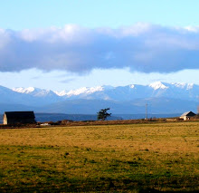
The hedgerows at Ebey's Reserve play a similar role in the landscape to the woody British icons. While the hedgerows at Ebey’s Reserve date back only to 1850, the time of early Euro-American settlement, they, too, provide a link to the past of the prairie and the first farms in the area. Hedgerows mark some of the original Donation Land Claim boundaries.


Hedgerows in the Reserve start as unmaintained fencelines, where grasses and shrubs are left to grow up rather than getting mowed. Birds that land on the fences excrete shrub and grass seeds, and more seeds are deposited by wind and water movement, or by small mammals, farm machinery and other vehicles. Before long, the fence becomes hidden among the vegetation, and the hedgerow can grow to be eight feet wide. Over time, a greater diversity of plant species in the hedgerow attracts more wildlife that works to protect the crops.


Hedgerows are beneficial because they…
• Control water runoff by slowing water down as it flows through allowing it to filter into the soil and the aquifer and deposit suspended silt onto the fields, as opposed to it washing into road ditches as it would without a hedgerow.
• Prevent loss of topsoil from wind and water movement. When nutrient-rich topsoil is lost, farmers make up for it by applying fertilizer, which is both expensive, and can overload water bodies with nutrients like nitrogen and phosphorus.
• Buffer wind to maintain soil moisture, leading to increased crop yields. Hedgerows with brushy vegetation and taller trees can increase precipitation over fields by up to fifteen percent.
• Help control pests by providing habitat for insect-eating birds, insects, small mammals and amphibians. Some resident birds feed on weed seeds. If this habitat is destroyed, farmers must instead use poisons, which, like fertilizers, are expensive, and can kill beneficial organisms, and often become ineffective against resistant strains.
• Improve wildlife habitat by providing shade, shelter, food and nesting sites for many mammals and migratory birds. They also provide habitat for bumblebees, which pollinate clover and other cover crops.


Photos by Sierra Young; post adapted from the Ebey's Landing "Hedgerows" brochure

Sunday, June 20, 2010

Barley

(Photo by Sierra Young)

Any plant that has spikelets ranks high on my long and growing list of cool things about Ebey's Reserve. Hordeum vulgare, or barley, is a grass grown as a cereal grain, livestock feed, and hops for brewing beer. At this time of year the spikelets give verdant fields all over the Reserve a soft look, especially when the wind creates wave patterns across acres of barley, inviting onlookers to relax and set their thoughts free onto the prairie.

Local farmer harvests barley on Ebey's Prairie in front of the Ferry House (Photo by Mitch Richards)

Barley is an annual grass, meaning it must get its seeds into the soil in order survive, unlike perennial plants, like the sunchoke, whose roots survive underground and store energy over the winter to sprout new growth the following year. Wild barley grows spikes that contain the seeds, and when these spikelets reach maturity they split open so that wind and animals can disperse the seeds. Domesticated barley, however, has a mutation so that its spikelets are non-shattering, making it easier to harvest the ears. Farmers then plant new seeds for the next year's crop.

Ancient Egyptians used barley to make beer and bread. It has also been a staple in Tibet since the fifth century A.D., where it is made into a flour product called tsampa. Today it is cultivated in temperate climates as a summer crop and in tropical climates as a winter crop. Barley thrives in cool conditions, but it not very winter-hardy, making the mild climate of Central Whidbey Island an ideal place to grow it. It is also relatively tolerant of soil salinity, making a practical seaside crop, as it is here.

(Photo by Sierra Young)

As you walk, bike, or drive through Ebey's Reserve, by all means enjoy the more distant vistas of the rugged Olympic Mountains, Mt. Baker and Mt. Rainier, but don't forget the simple beauty of barley fields on the prairie--the same fields that the pioneers began farming here more than 150 years ago.

Post by Sierra Young

Monday, June 14, 2010

Helianthus tuberosus

What do potatoes, artichokes and sunflowers all have in common? They are all ways I have heard sunchokes described. Heliantus tuberosus, known commonly as sunchoke or Jerusalem artichokes, is a type of perennial sunflower, with a tall stock that grows in the summer and blooms with a yellow flower, smaller than that of the common sunflower Helianthus annuus.

Sunchoke plants at the Coupeville Farmers Market on Saturay (Photo by Sierra Young)

After the stock dies back it grows tubers underground, like potatoes, to store carbohydrates through the winter. Those tubers can be broken off the main root of the plant and harvested all winter long. The plant gets the name Jerusalem artichoke because of its sweet nutty flavor, akin to artichokes.


Sunchokes have a crisp texture when raw and make a tasty addition to a salad. They can also be treated just like potatoes when cooking: au gratin, boiled, added to soups and casserols, you name it.

Post by Sierra Young